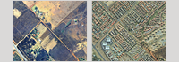
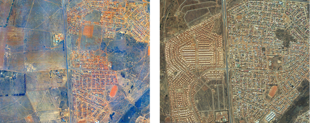
The study by Mubiwa and Annegarn (2013) has revealed significant growth in urban land cover over the past two decades, with the majority of the growth occurring as suburban sprawl on the fringes of the city-region.
Despite its good intentions,
the establishment of large low-cost RDP housing settlements and
growth of informal settlements long distances
(where land is cheaper) from the economic centres, has
perpetuated the apartheid urban form.
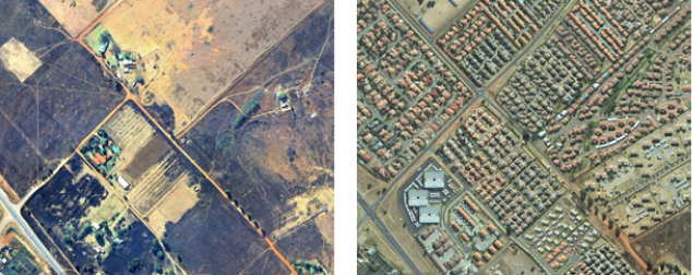
The development of single-use office-parks separate from residential areas has further propagated fragmentation. The footprint of the apartheid spatial planning is proving difficult to retrofit.
However, there is sufficient evidence to show
despite widespread sprawl,
there have been cases of managed growth,
including areas of corridor development
and urban densification.
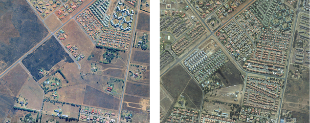
In light of adverse social, economic and environmental costs of continued unrestrained lateral expansion, it is crucial to manage urban growth. One of the urban densification options is to pursue brownfield development where existing built up areas are redeveloped ideally at higher densities, instead of converting open land on the fringes for low density housing projects. As land-use structures also have effects on transport-related energy consumption, mobility patterns, trip-distances and modes of transport, it is essential to plan for the kinds of growth trajectories and policies that promote spatial, mobility and energy efficiencies.
However, if the current trends continue, the negative implications of some land-use conversions (i.e. natural to urban land cover/use) are imminent.