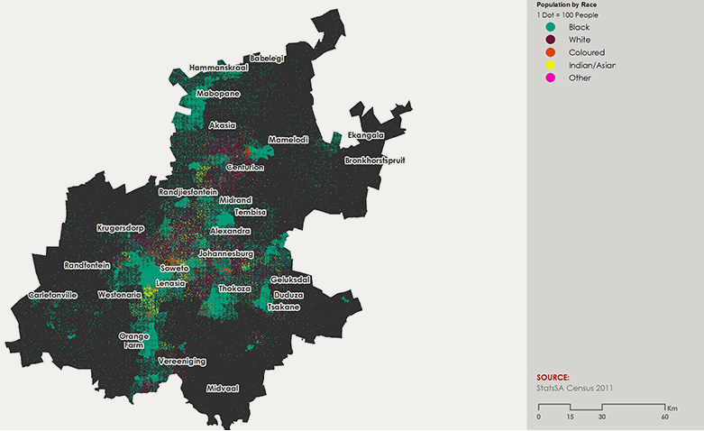
We recognise that, given the limitations of statistical data and empirical research on residential segregation in Gauteng, this map can only offer broad brushstrokes toward a clear picture of a society in transition. However, it is possible to use the map to discern some interesting trends regarding racial integration.
Perhaps the most visible manifestation of change can be seen through some deracialisation of a number of historically white suburbs in Gauteng, suggesting the influx of a growing Black middle class. There is a small but significant degree of racial mixing in the northern suburbs of the City of Johannesburg, from the Midrand area to the upmarket Sandton suburb, as well as certain suburbs close to or surrounding Pretoria (e.g. Centurion or Randjiesfontein). Some degree of racial mixing can also be seen in inner city Johannesburg. Similarly former townships designated for the Black, Indian and Coloured population such as Soweto, Lenasia and Eldorado Park show equal evidence of some racial integration.
It may be cautiously said that this trend toward racial integration in Gauteng’s former Black, Coloured and Indian townships could suggest a possible rewriting of the complex spatial history of townships in the province.
By contrast, the map also shows great swathes of racial exclusivity in some white suburbs as well as certain areas of southern Johannesburg with mainly Coloured and Black residents. Although there is slow movement toward racial integration, this map generally represents a confirmation of the continued salience of the racial fault-line in the spatial and physical landscape of Gauteng.


